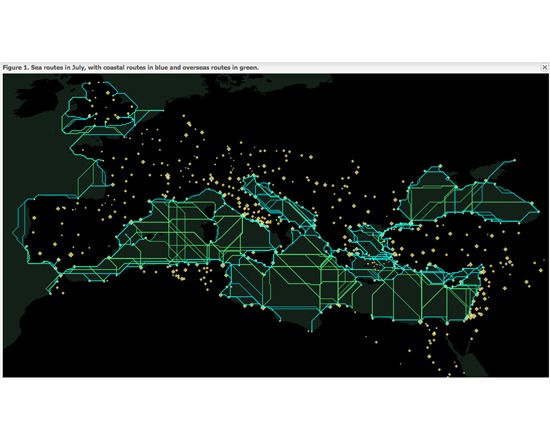
ORBIS: Stanford Geospatial Network Model of the Roman World
- Last Updated: 11/7/2018 12:00:00 AM
- Site: http://orbis.stanford.edu/
ORBIS: Stanford Geospatial Network Model of the Roman World is a tool and academic resource for reconstructing the time and financial costs of travel in the ancient world. Its model is based on a simplified network of Roman cities, roads, rivers and sea lanes, and takes into account such factors as time of year and method of travel. Users can enter parameters to generate models and interactive maps.
Documentation
Creator(s): Walter Scheidel and Elijah Meeks
Creator's Site: http://www.stanford.edu/~scheidel/
Creator's Email: scheidel@stanford.edu
Repository:
Attributes
- Type of analysis: Search Visualization Analysis Discovering
- Type of license: Free
- Background Processing: Not Applicable
- Web Usable: Run in Browser
- Ease of Use: Easy
- TaDiRAH Goals: Analysis
- TaDiRAH Methods: Discovering Visualization
List this tool appear on
Rating
Suggested Tools
Comments
Hello rfd_0954,
Thank you for your feedback. Could I trouble you for your input on how we could make it easier for you to find the links? TAPoR 2.5 can be contacted directly at tapor@ualberta.ca.
At the moment, you can access ORBIS's homepage by clicking the thumbnail picture or the name of the tool. We've also provided a direct link to its documentation, also from the tool's website. You can find this link at the top of the 'Documentation' column, just below the image.
Once you've checked it out, we'd love to have your impressions!
ORBIS also appears in Project Bamboo's DiRT, a registry of digital tools suitable for academic research. DiRT contains a wide range of tools and software searchable by task, such as annotation, content management, collaborative research, or authoring. It is an excellent resource for Digital Humanists seeking the right tool for the task at hand.
View ORBIS in DiRT:
http://dirt.projectbamboo.org/resources/orbis
View the full site:
http://dirt.projectbamboo.org/