Skip to content
TAPoR Text Analysis Portal for Research

For researchers who work with text

Find a text analysis tool that fits the work.

TAPoR catalogues concordancers, annotators, topic models, stylometry packages, and visualization environments. Every record notes the platform, the license, and what the tool is actually good for.

  • Platform, license, and method on every record
  • Reviews from people who teach with the tools
  • Lists assembled around a course or a corpus

Browse tools

Filter by the type of analysis.

View all tools
‹

Visualization

forTEXT

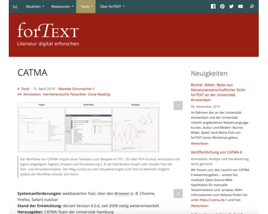
forTEXT is a free web service, which helps scholars who are interested in the Digital Humanities to choose digital methods and tools according to their research setting. forTEXT is especially designed for scholars with no or little experience in the field of Digital Humanities. The focus currently lies on literature studies and language, but will be broadened in the future. forTEXT provides scientific insights into traditions and techniques of the Digital Humanities and offers video and text tutorials as well as teaching materials. Currently, forTEXT offers content in German, but is going to be translated into English and other languages soon.
Rated 0.0 out of 5.

Visualization

FusionCharts

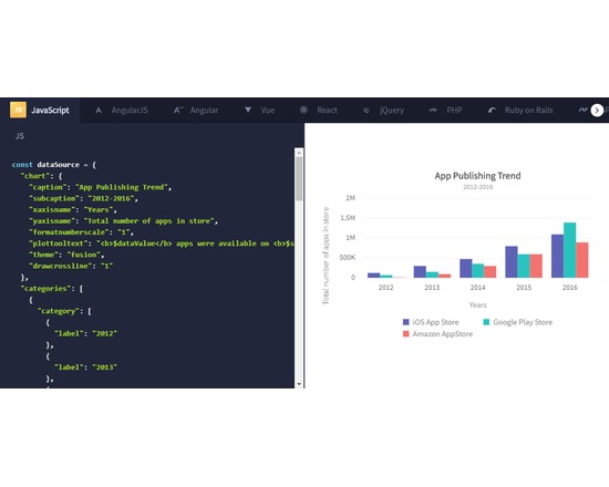
Enterprise-grade JavaScript charting library for web & mobile apps.

Rated 0.0 out of 5.

Visualization

GapVis

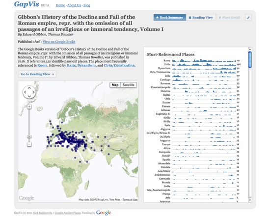
GapVis is a free tool developed in conjunction with Google Ancient Places to visualize the locations within and allow the exploration of books referencing ancient places within the Google Books collection. Users can view text summaries, use an enhanced reading interface and explore the location references through a place detail view. It is intended both to enable location-based text discovery, and to allow users to delve more deeply into a text based on the locations referenced within it. GapVis is currently in beta.

Rated 0.0 out of 5.

Visualization

General Inquirer Category

TATR: This notebook is part of a greater series of Juypter Notebook structured around Twitter Tweet analysis. This particular notebook will look at categorizing text using the General Inquirer Categories released by Harvard (http://www.wjh.harvard.edu/~inquirer/spreadsheet_guide.htm). This notebook will showcase how to break down the General Inquirer Category into a dictionary and how it can be tailored to fit your needs.

Rated 0.0 out of 5.

Visualization

GeoRSS

Geographically Encoded Objects for RSS feeds. GeoRSS was designed as a lightweight, community driven way to extend existing feeds with geographic information. As RSS and Atom become more prevalent as a way to publish and share information, it becomes increasingly important that location is described in an interoperable manner so that applications can request, aggregate, share and map geographically tagged feeds.RSS Map of Digital Humanities centers Two primary GeoRSS encoding exist, including GeoRSS Geography Markup Language (GML) and GeoRSS Simple. GeoRSS-Simple is a lightweight format that supports basic geometries of point, line, box, polygon. GeoRSS GML is a Open Geospatial Consortium (OGC) GML Application Profile, and supports a greater range of features than GeoRSS Simple.

Rated 0.0 out of 5.

Visualization

GeoTemCo

The amount of online data annotated with geospatial and temporal metadata has grown rapidly in the recent years. Providers like Flickr and Twitter are popular, but hard to browse. Many systems exist that, in multiple linked views, show the data under geospatial, temporal, and topical aspects. GeoTemCo is a web-application which easily can be utilized to visualize such kind of data, and furthermore, it allows the comparative analysis of several datasets. GeoTemCo consists of several views showing the datas' several dimensions: a map view for the geospatial distribution of items, a time view for the temporal distribution of items and a detail view for the inspection of individual items. A broad range of interaction abilities allows for explorative comparison and analysis of different datasets representing different topics. GeoTemCo focuses on supporting the user to: - analyze and compare temporal trends - analyze and compare geospatial distributions - detect cooccurences between data items of different datasets - compare geospatial migrations of topics over time - find causalities between different datasets

Rated 0.0 out of 5.

›

Curated lists

Curated list created by experience authors in the fields.

All curated lists

Geoffrey Rockwell

Cool Voyant Tools

Not all Voyant tools show up in the default view or skin. Here is a list of some of the other tools worth trying.

4 tools

View list

Holly Pickering

Audio Production Software

Interested in audio production and editing? Here are a few programs that can help you get on your way. Some of them are free, some not, but all are helpful and useful.

3 tools

View list

Jason Bradshaw

TATR: Text Analysis for Twitter Research

This list compiles a suite of tools that make up Kynan Ly's Text Analysis for Twitter Research (TATR) Library. Recipes to these notebooks can be found on methodi.ca

6 tools

View list

The catalogue

  • 1321

    Tools catalogued

  • 15

    Curated lists

  • 22

    Analysis types

  • 671

    Community reviews

More is coming

Researchers, power users, and students will soon be able to contribute tools, share reviews, and curate lists around their own work.