Modeling
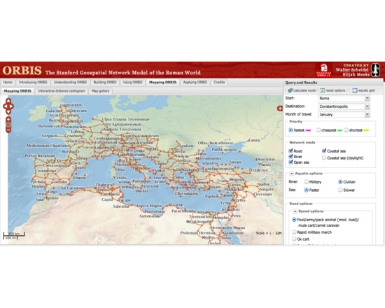
ORBIS: The Stanford Geospatial Network Model of the Roman World
ORBIS is an "interactive scholarly work" that allows a user to determine the cost, time, and distance of various land, sea, and river routes among hundreds of sites in the ancient world, at various times of day and in various seasons. The work can be (and has been) used as a tool to study questions in various fields of study about antiquity, including trade and social interaction.