Skip to content
TAPoR Text Analysis Portal for Research

Tools

Sort by Name Rating Date ↓

MapTiler

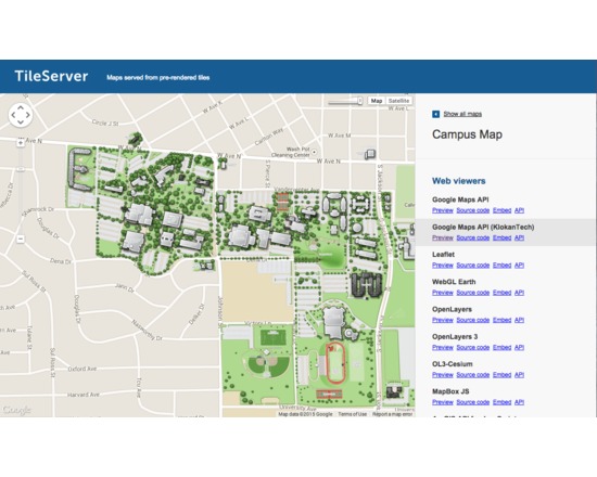
MapTiler allows efficient and fast multi-core paralellized rendering of raster geodata (TIFF/GeoTIFF, MrSID, ECW, JPEG2000, Erdas HFA, NOAA BSB/KAP, Ozi Explorer OZF2/OZFx3, JPEG, GIF, PNG and more…) into map tiles suitable for Google Maps API mashups (OpenStreetMap, Microsoft Bing, MapQuest, MapBox, Google Earth; MBTiles format is supported), native mobile applications (iPhone/iPad/Android) with Apple MapKit, RouteMe or OSMDroid. It automatically produces large seamless maps from several input files (MapTiler Pro) and directly optimizes the produced tiles for minimal filesize which allows extremely fast distribution of maps from any ordinary webserver or from a cloud CDN (Rackspace Cloud Files, Apache, PHP, Linux, DropBox, Google Drive, Amazon S3/CloudFront, Google Cloud Storage). Interaction with the software and tips are available in Youtube tutorials at:https://www.youtube.com/playlist?list=PLGHe6Moaz52PiQd1mO-S9QrCjqSn1v-ay

Rated 0.0 out of 5.

Visualization

DH Press

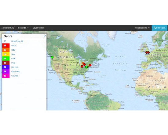
DH Press (originally called diPH) is a toolkit conceived as an easy-to-use WordPress plugin which allows potentially every kind of user to visualise and mashup historic and geographic information, documents and various types of multimedia content to develop digital humanities project. The user cannot start from the toolkit itself, as the first step to set up a project, when the toolkit is already installed, is a CSV import. This means that the raw information has to be processed first, through any software like Microsoft Excel or Google Spreadsheet, following some conventions dictated by the toolkit, and once completed must be exported in CSV format. The file can then be imported into DH Press. At this point, the user finally has full control over the data. First, the toolkit needs to be informed of what kind of data is in each column, as it can handle various types, such as Short Text, Long Text, Lat/Lon, Date, and Link. The steepest learning curve resides here, in the data management part, as the database must be set up very carefully, and fixing any problem later is complex. This does not mean that new users cannot approach the tool, but some basic research on data management is required to make correct use of it. After setting up all this fields, called “motes” in the toolkit, a legend can be assigned to each of them, for example a field called “city” might contain, through multiple entries, ten different cities, and to each of those will correspond the colour chosen by the user. It is also possible to assign icons or png images instead of colours. A single control panel then allows the user to create, set up and manage multiple visualisations of different kind, and in each of them the user can choose which information to display and how. This part is the most useful and is really straightforward. The last section of the control panel lets the user set up custom fields for data and run a test of the whole project, and outputs detailed error information. Following the training page, http://dhpress.org/training/, it is possible to take advantage of a pre-existing database, which can be used to quickly set up a project, so that one can instantly work on the main control panel. There is a detailed google document that guides the user through the process step by step, and also offers an even more detailed annex. A couple of hours is enough to go through all of it and get the necessary information to use it correctly. Then, any view can be quickly set up and customised in any desired way. Overall, this toolkit is quite stable, reliable, user-friendly after the first entry barrier and gives you a varied set of tools to visualise and display a large amount of data in a neat, organised manner. For a more detailed and personal review, please read http://claudiasartori.com/2015/01/tool-review-dh-press/

Rated 0.0 out of 5.

Publishing

Open Journal Systems

Open Journal Systems (OJS) is a journal management and publishing system. Public Knowledge Project (the sponsor of OJS) is a multi-university initiative developing (free) open source software and conducting research to improve the quality and reach of scholarly publishing

Rated 0.0 out of 5.

Collaboration

DEVONthink

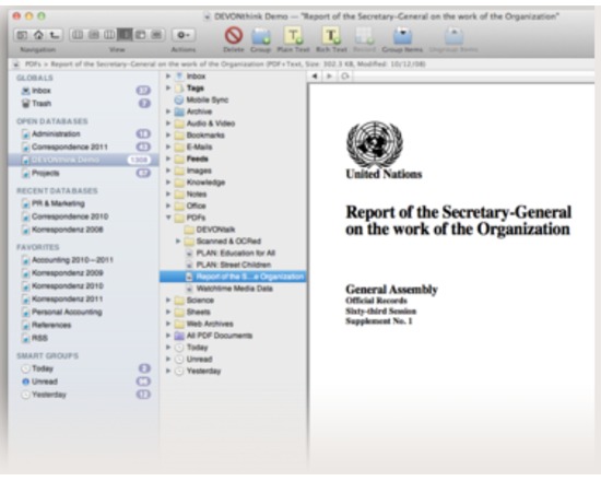
DEVONthink is a database that helps users organize, manage and collaborate on digital files, including Office files, links, e-mails, research data and PDFs.

Rated 0.0 out of 5.

Web development

Adobe Dreamweaver

A visual development tool for creating, publishing, and managing websites and mobile content: Dreamweaver offers a graphics-based WYSIWYG (What You See Is What You GET pronounced wizzywig) and code-based user interface for the development of web pages and sites. The tool may be used to simplify the process of web site development (in comparison to creation of individual web pages), through the provision of a templating system that allows single-source update of shared code and layout across entire sites without server-side includes or scripting. Features: WYSIWYG Code hinting for Ajax and JavaScript frameworks Subversion integration FTP/SFTP support WebDav support Web site template system Adobe Spry AJAX framework support

Rated 0.0 out of 5.

Creation

Plone

Plone is a powerful, flexible, open source Content Management System (CMS) built on top of Zope application server and CMF. Features: - Flexible and adaptable workflow - Customisable - Free add-ons - Versioning, history and reverting content - Support for multiple mark up formats - Multilingual content management - RSS feed support - WebDAV and FTP support - WYSIWYG - Integrates with Active Directory, Salesforce, LDAP, SQL, Web Services, LDAP and Oracle

Rated 0.0 out of 5.

PolyMeta

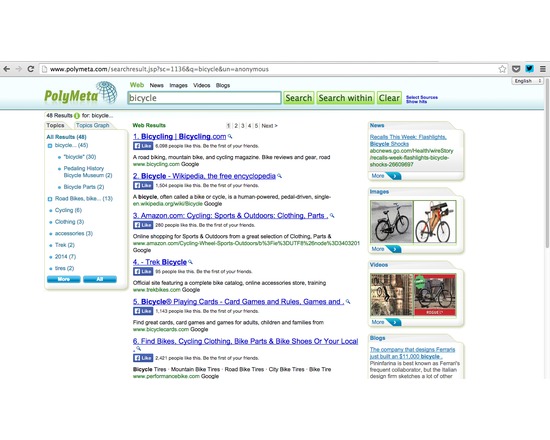
PolyMeta is a metasearch engine that displays the search results in the form of clusters and images. The results are sorted according to source and category.

Rated 0.0 out of 5.

Dissemination

bitly

Bitly is a link shortening service that also helps you share, track, and analyze your links. Now includes "bundles" which can be public or private, to gather your links by categories you choose. A social network style feed of other people's bitly links can be added to your dashboard. An iOS app is available for iPhone. Wordpress plugin and API are available. Site includes a sub-site about the API for developers here: dev.bitly.com

Rated 0.0 out of 5.

Modeling

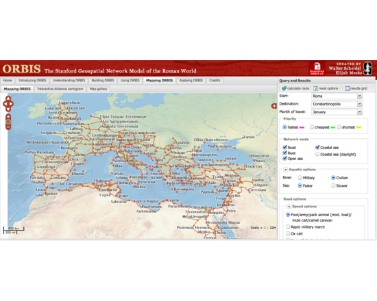
ORBIS: The Stanford Geospatial Network Model of the Roman World

ORBIS is an "interactive scholarly work" that allows a user to determine the cost, time, and distance of various land, sea, and river routes among hundreds of sites in the ancient world, at various times of day and in various seasons. The work can be (and has been) used as a tool to study questions in various fields of study about antiquity, including trade and social interaction.

Rated 0.0 out of 5.

Collaboration

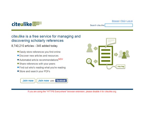
CiteULike

CiteULike is a free service to help you to store, organise and share the scholarly papers you are reading. When you see a paper on the web that interests you, you can click one button and have it added to your personal library. CiteULike automatically extracts the citation details, so there's no need to type them in yourself. It all works from within your web browser so you can access it from any computer with an Internet connection. CiteULike supports annotation and rating of items, and upload of attachments (e.g. PDF file). (Attachments are only accessible privately by individual users). Bibliographic entries can be imported singly or in batches using BibTex or RIS formats.

Rated 0.0 out of 5.