Skip to content
TAPoR Text Analysis Portal for Research

Tools

Sort by Name Rating Date ↓

Organizing

KORA

KORA is an open-source, database-driven, online digital repository application for complex multimedia objects (text, images, audio, video) created by MATRIX. The application ingests, manages, and delivers digital objects with corresponding metadata that enhances the research and educational value of the objects. KORA's flexible architecture can accommodate any metadata scheme allowing for individualized digital collections with differing contents and metadata structures.

Rated 0.0 out of 5.

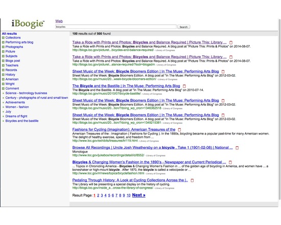
iBoogie

iBoogie is a clustering search engine that puts documents with similar content or with related topics into the same group. Each group is assigned a label based on the content of the documents. The results are presented to the user in a hierarchy of topics (clusters) for browsing.

Rated 0.0 out of 5.

Visualization

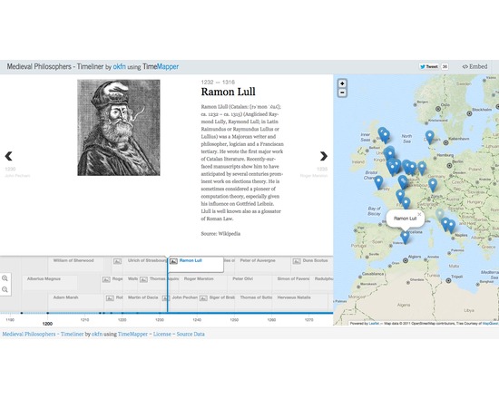
TimeMapper

TimeMapper is an open source timeline tool that takes information in a Google spreadsheet and uses it to generate a timeline that can then be published, shared, or embedded on the web. It utilizes components from other open source tools like TimelineJS and Leaflet maps. It is simple to use, but not easily customizable.

Rated 0.0 out of 5.

Organizing

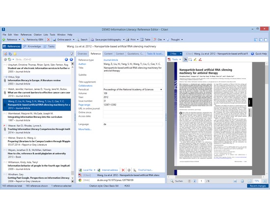
Citavi

Citavi's core features are reference management, knowledge organization, and task planning. Reference management Search in thousands of databases and library catalogs from within Citavi Organize references Annotate and automatically rename PDF files Batch import PDF files and import their metadata automatically Find fulltext to references Collaborate with others on a local network (no need to have your data in the cloud) Import from other reference management programs and formats, including RIS and BibTeX Import ISBNs, DOIs and PubMed-IDs on web pages with a click Import web pages with a click Transform web pages into PDF files to save their content Work seamlessly with Word (versions from 2003) Send references to Open Office and LibreOffice Writer and any program that can process files in RTF (i.e. Scrivener) Use with LaTeX editors Create subject bibliographies with a click Publish in all common citation styles. Styles for journals can be requested" target="_blank" for free Integrated citation style editor Advanced style finder Integrated quick help Interface and quick help in seven languages (English, French, German, Italian, Polish, Portuguese, Spanish) Knowledge organization Import text excerpts and images from documents as quotations and organize them together with summaries, comments and own ideas imported as "thoughts" Quotations, summaries, comments and thoughts can be outlined directly in Citavi to reflect the structure in chapters of the publication prior to the actual writing, thus permitting to separate the construction of the argumentative structure from the actual writing process Task planner Schedule tasks related to titles (order, photocopy, extract citations, read, check, ...) and milestones Print lists of to do lists with a click

Rated 0.0 out of 5.

Xendo

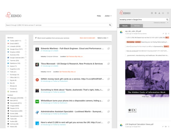
Xendo is an online research tool that provides unified search across cloud-based storage (such as Dropbox, Evernote, Google Drive, OneDrive) and email (such as Gmail, Office 365) and other services such as Slack, Trello and Asana (25 integrations to-date). Xendo offers advanced search capabilities such as proximity searching (looking for term or phrase within a number of words of a second term or phrase). Xendo uses OCR (Optical Character Recognition) to make scanned documents searchable. For some services, Xendo offers a content preview to speed research.

Rated 0.0 out of 5.

Visualization

Kartograph

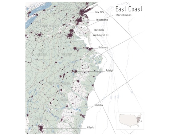
Kartograph is a pair of free and open source libraries for representing data with a spatial component on webpages or in print. The first library, Kartograph.py, is a Python library that builds lightweight vector graphic maps from either shapefiles or PostGIS tables. These graphics files can be styled either using a cascading style sheet during creation or later on the second library, Kartograph.js. The vector files can also be edited and enhanced in a vector graphics program like Adobe Illustrator. Kartograph.js allows the user to create interactive maps for web pages and web applications, using vector graphics files and data files to both draw the basemap and the features of interest. Unlike many web-based mapping libraries, Kartograph.js requires no server or even internet connection. All of the pertinent information is in the vector and data files. The results are highly customizable and can absolutely arresting, visually.

Rated 0.0 out of 5.

Creation

Perl

Perl is a high-level, general-purpose, interpreted, dynamic programming language. Originally developed for text manipulation, it is now used for a wide range of tasks including graphics programming, system administration, network programming, applications that require database access and CGI programming on the Web. Features: - C, shell scripting (sh), AWK, and sed - Powerful text processing facilities - Flexibility and adaptability -Support for multiple programming paradigms -Reference counting memory management

Rated 0.0 out of 5.

Visualization

Omeka

Omeka is a content management system designed for the display of library, museum, archives, and scholarly collections and exhibitions. Omeka falls at a crossroads of Web Content Management, Collections Management, and Archival Digital Collections Systems. Omeka is designed with non-IT specialists in mind, allowing users to focus on content and interpretation rather than programming. It brings Web 2.0 technologies and approaches to academic and cultural websites to foster user interaction and participation. It makes top-shelf design easy with a simple and flexible templating system. Its robust open-source developer and user communities underwrite Omeka’s stability and sustainability. Omeka allows users to publish cultural heritage objects, extend its functionality with themes and plugins, and curate online exhibits with digital objects.

Rated 5.0 out of 5.

MapWarper

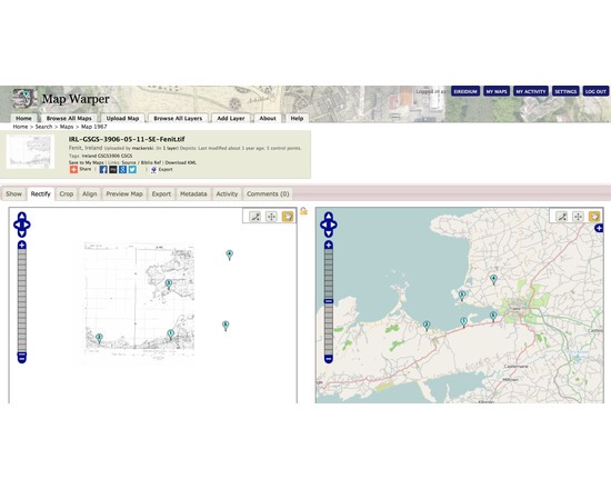
Map Warper is a tool for digitally aligning ("rectifying") historical maps to match today's precise maps. It is used publicly by the NYPL to crowdsource georectification of their own library of digitised historical maps. In the wider version developed by Tim Waters user supplied maps can be georectified for subsequent use in your own mapping projects.

Rated 0.0 out of 5.

Creation

RStudio

RStudio is an integrated development environment (IDE) for R. It is available in both open source and consumer versions, and can run either on your desktop, or through a browser connected to RStudio Server. Features include syntax highlighting, code completion, smart indentation, and an interactive debugger.

Rated 0.0 out of 5.